Friday, October 14, 2011

Autumn at Bear Lake


The opening photo is taken from Temple canyon looking east to the south corner of Bear Lake. The east side of the lake is in Wyoming.
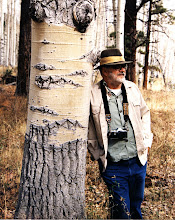
Bear Lake is on the Utah-Idaho border, at an altitude of about 6000 feet. The primary trees that turn good colors in the fall are big tooth maples and quaking aspens. On this particular expedition my son Dean and I stayed at the Edwards Lodge on the shores of Bear Lake and enjoyed a tour guided by the Old White Haired guy and The Saint. Dean and the guides are shown below.


Below: View from Edwards Lodge


The series of photos that follow are from an area called Temple Flat. The trees that have turned yellow are quaking aspen("quakies"). If I remember my GPS readings right they are about 7500 feet high.


I love to shoot quakies backlit to capture the glow that the sun produces shining through the yellow leaves. You have to be careful doing this to keep the sun from shining directly on the lens. I have a lens shade that came with the lens but my favorie and most effective is my hat. If you are using a tripod it makes it a lot easier to use your hat as a sunshade. The effect of backlighting is shown in varying degrees in the photos below.


The image below was taken in Logan Canyon.

Tuesday, September 27, 2011

The Eagle and Bluebell, Eureka, Utah


The Eagle and Bluebell mine is an old mine in Eureka, Utah. Silver and/or gold was found in this area in the 1860's and the Tintic Mining District organized in 1869. The Eagle and Bluebell was begun around this time although under a different name. About 1897 it was purchased by the Bingham Mining Co, the same company that developed the huge copper mine in the Salt Lake Valley. The Eagle and Bluebell sits about halfway up the mountain to the south of the town of Eureka. Over time a very large tailings dump developed. A railroad spur was brought in to allow ore to be loaded directly from ore bins and transported to a smelter/mill. Between 1897 and 1916 220,000 tons of ore was taken out of this mine. From this ore 35,000 ounces of gold, 3.2 million ounces of silver, 1.4 million pounds of copper, 34 million pounds of lead and 23,000 pounds of zinc were extracted.


The photo above shows the Eagle and Bluebell surface plant.The head frame is positioned over the shaft; to the left the grayish building houses the hoist, basically an electrical winch, by which men and equipment are raised and lowered into the mine. The photo below shows the interior of the hoist room with the massive hoist.


The next photo shows the belt/cable running from the hoist out of the building. This belt goes over the wheel at the top of the head frame and attaches to the cage containing the men or equipment. The two large discs are part of the method by which the depth of the cages in the shaft was determined.


For me the most intriguing thing about the Eagle and Bluebell was the ore bins, shown below. Mine cars were run out onto the top and then dumped down chutes into the ore bins. The railroad track ran between the bins. The construction is massive. Many of these timbers are tree trunks. I do not know when this was constructed, but I believe it was early in the 20th century.


Below is a photo taken in the space between the ore bins where the train ran.


Below are two views from the top with Eureka in the valley below.


Below is the top of the ore bin structure without the shack. The tracks lead to the chutes via which the ore was dumped from the mine cars into the bins.


This is the shack on top of the bins. I don't think anyone will be running any mine cars out there any time soon.


The Eureka mines ran off and on during the great depression, then full bore through World War II. After that some of them ran sporadically into the 1970's.

My grandfather ran the substation for the electric company from 1917 until his retirement in the 1950's. His house and the sub were just down the hill and to the east of the Eagle and Bluebell. The miners generally walked to work and had worn a trail in the snow about wide enough for a man to walk on. This trail got nicely packed down and was a great sled run for my dad and his friends, at least until they encountered a couple of miners on their way to work. Miners and lunch buckets flew everywhere. Being wise and afraid of the consequences, the boys kept going.

A note on the photographs--I have photographed in and around Eureka several times over the years, although not recently. The only recent photo I could find on the internet of the ore bins was taken in 2006 and showed the top shack gone. I'm not sure what else has gone on in the interim. I guess I need to have another go at Eureka.

The photographs shown here were all taken in 1990, when I got permission from the caretaker to be on the property. The photos were all originally in color, 35mm transparency film, probably Fuji. They were scanned using a Minolta film scanner. The black and white conversions were done with Silver Efex Pro 2

Monday, September 12, 2011

Barns of Cache Valley

Cache Valley is a high mountain valley in northern Utah, home to Utah State University. Logan is the largest city in the valley. Cache Valley was a site for mountain men, fur traders and trappers to rendezvous in the first half of the 19th century. It was first settled by white men in the 1850's. The valley is very agricultural with a number of barns scattered around, some new and others in various states of disrepair. What follows are some that I have photographed over the years.

This first barn is on a hillside in Mendon, a small community on the west side of the valley.


This barn is also in Mendon. I love the pattern the lack of shingles makes with the light coming through the roof. The cupola is also from this barn.


I believe this handsome old barn is in Trenton.


The barn shown below is in Clarkston. I'm not sure but I think it may have been a house at one time. The horses don't seem to care one way or another and were singularly non-communicative.


The barn and old house shown below are in Clarkston. There is a newer, modern house on the place as well, not shown in the photographs.


This mural is on the side of a modern farm building/barn in Trenton.


This bit of whimsy is on a barn in Whitney, Idaho. The northern end of Cache Valley extends into southern Idaho.


The photo below is obviously not of a barn, but it is an abandoned bit of agricultural equipment. It is near Mendon.


This is what eventually happens to the old structures if not maintained. I hope the truck isn't needed in a hurry.

Wednesday, August 24, 2011

Hallowed Ground


The dictionary defines hallowed as something regarded as holy; venerated; sacred. On our recent road trip we saw three places that are definitely hallowed ground.

Island No.10 is in the Mississippi River, just south of Cairo, Illinois. It was held by the Confederacy until the spring of 1862, when it was attacked and put under siege. After a protracted struggle, the Confederate troops realized they were in an untenable position and surrendered. The captives were sent to Camp Randall in Madison, Wisconsin. They were generally in poor condition; many were wounded and diseased. Some 140 graves were soon filled, and thus the most northern Confederate cemetery came into being. Their graves were lovingly tended for over 30 years by a gracious Southern lady, Alice Whiting Waterman. Next to the Confederate graves is a group of graves of Northern soldiers who died in the vicinity of Camp Randall.


Above is the Confederate Section of the cemetery and a couple of graves with flowers.
Below is the Union section.


The Battle of the Little Bighorn occurred on June 25 and June 26, 1876 along and just north of the Litle Bighorn river in southwestern Montana. It was a battle between the US 7th Cavalry led by Lt. Col George Armstrong Custer and the Lakota Sioux, Cheyenne and Arapaho Native Americans. This battle and battleground is one of the most studied in the world. 268 US soldiers and scouts were killed, including Custer, and another 55 wounded. The number of Native American casualties is not known.

Below is a view of the battlefield from just below the hill where Custer and the troops that were immediately around him died. At the bottom of the hills in the trees is the Little Bighorn River, where the Native American encampment was.
The next photo was taken from the same place as the first, the photographer turning 90 degrees to the left(east). The monument is to the men of the 7th Cavalry and is on the spot Custer's body was found. The gravestones in the fence below the hill are for the men that died near Custer, with the attempt made to place the markers where their bodies were found.


The photos below look southwest across the graves near the top of the hill to the Little Bighorn in the trees at the bottom of the hills.


The photo below shows the Native American Memorial just north of the Custer memorial.


The photo below was taken from the bluffs just above the Little Bighorn. Major Reno and Captain Benteen established defensive positions on these bluffs and managed to survive with some of their troops.


This photo is on the east part of the battlefield with markers placed where soldiers died.


Standing on the battlefield one gets the feeling of great tragedy for all involved and for our nation as a whole. Hallowed ground.


In May of 1856 a group of Mormon converts, known as the Willie company, sailed from England to the United States. Their ultimate destination was Salt Lake City. They traveled to Iowa and Florence, Nebraska where they put their belongings and provisions in hand carts and began the trek west. By now it was August, and although warned they were too late and should winter over in Iowa or Nebraska they decided to go on to Utah. There were about 400 people who left Florence, Nebraska on August 17. They had a number of problems: the handcarts were made from green wood and broke down; their cattle got mixed up with a buffalo herd and 30 of them were killed; they thought they were to be resupplied at Fort Laramie but there were no provisions for them at the Fort. They ran out of provisions about October 17 , near the sixth crossing of the Sweetwater River in Wyoming. A blizzard struck at the same time with winds, heavy snow and freezing temperatures. A rescue party sent from Salt Lake City found them on 21 October. Eight people died and were buried at the sixth crossing. The night of the rescue they held a meeting and voted unanimously to send half the rescue party on to find the Martin company which was about 70 miles behind them. That selfless act resulted in the death of another 12 people as they fought their way up Rocky Ridge and down to Rock Creek Hollow.

The photos below show the Oregon-Mormon trail leading to the sixth crossing of the Sweetwater, which is hidden by the trees. The Bureau of Land Management, who has control of this land, says that this area is unchanged since 1856. An awful place to be trapped in a blizzard. Frozen ground, snow, wind and no cover.


The campsite at the sixth crossing is marked by a monument to one of the pioneers who died there, John Linford. It is in the middle of the trail, about one-half mile from the river itself. I know of no ground more hallowed than this.


Wednesday, August 3, 2011

Mad Town

We just returned from a loooong road trip on which a good time was had by one and all. One of the places we visited was Madison, Wisconsin where our daughter(Frau Magister) is attending the University of Wisconsin. Madison is a relatively small city, 233,000 in the 2010 census. It is the state capitol and the home of the U of Wisconsin. It is pretty, on the shores of two lakes, Mendota and Monona with three other lakes in the immediate vicinity.

The state capitol building has four streets that surround it and then other streets run out from these four, somewhat like spokes.


A farmer's market is held every Saturday morning on the street surrounding the capitol.One can find a great variety of things at this market, cheese of course and venison and Wisconsin maple syrup and lots more.


I got a chuckle out of the vendor below. FIBs is Wisconsinese for "F...ing Illinois Bastards", not "Fine Italian Beef and Sausage".


One of the streets, State Street, has been turned into a pedestrian mall and runs from the Capitol to the University campus, a mile or so away. State is lined with restaurants, shops, bars and taverns and is a fun stroll. On campus the Union has a Ratskeller with a terrace on the shore of Lake Mendota. Very pleasant to get a brat and beverage of your choice, grab a table in the shade and relax.


There was an Army camp located in Madison begun at the time of the Civil War, called Camp Randall. All that is now left of the site is the UW football stadium, called appropriately, Camp Randall. The farthest north Confederate cemetery is in Madison. A group of POWs was sent to Camp Randall for internment following their surrender on an island in the Mississippi River. They were in poor condition on capture and many of them died at Camp Randall. The photos below show two of the graves and a plaque telling the history.


Wisconsin has a long history of political activity and protest. This past spring they had the biggest protests they have had since the Vietnam War. It was over funding of benefits for public employees and unionization of public employees. Protesting there is made easier for the students because of the short distance from campus to the Capitol down the State Street pedestrian mall. Frau Magister and her husband were able to observe it all, even singing along with Jesse Jackson on “We shall overcome”. Nice to know Jesse has something to occupy his time. We visited the Capitol about noon, and the daily protest was just getting going. About 100 people were in the rotunda, complete with song books and banners. Took me back to days of yore and my misspent youth. The opening photo shows some protesters on the steps to the capitol; below are the noon protesters in the rotunda.


A word on the Wisconsin Badger. I had always thought that the Badger was nothing more than the UW mascot. Not so. The badger is a symbol for the whole state. Early settlers were lead miners and dug burrows to live in to survive the winter, and so were nicknamed “badgers.” Badgers are present in the Capitol building and on the head of the chick on top of the building. Beats the muskrat on Donald Trump's head.