Showing posts with label Utah. Show all posts

Friday, September 13, 2013

The All American Man


There is a large National Park in Southern Utah called Canyonlands National Park. It covers a territory of canyons, arches, standing rocks, creeks and portions of the Green and Colorado Rivers including the confluence of the two rivers. It is very wild and remote, with much of it accessible only to 4 wheel drive(4WD) vehicles, backpacking or raft. There is also some mountain biking.

Canyonlands was made a National Park in 1964. Sometime in 1964 National Geographic ran a story on Canyonlands, which I saw somewhere, although I was not a subscriber. I remember being very impressed and decided that I needed to explore that area. In 1969 or 1970, while I was in practice in Utah I laid into a Ford Bronco, 4WD. I also got a large scale map of Canyonlands and managed to locate a copy of the National Geographic issue on Canyonlands at a used bookstore. I then started plotting trips.

One of the most striking things in the article was a photo of a pictograph called The All American Man. This is what is called a shield figure, which there are several of in this area. However, this one's shield is in a red, white and blue pattern. It is the only one like this ever found. I decided I had to see him.

I located him on my map, packed up food and water, etc. and went for it. The entrance to the Needles district of the park, which is where the All American Man is located, is south of Moab. A little ways into the park is a sandy wash called Salt Creek. I turned off the park entrance road and drove south up Salt Creek. For the most part I drove up the creek bed. Salt Creek always has water in it somewhere, unless there has been a big storm, when it has water everywhere. The water was never deep enough to cause trouble. I drove past the small side canyon where Angel Arch is located and continued south for about another seven or so miles. The All American Man is located in a cave the mouth of which is about 10 or so feet above the canyon floor. At the point I stopped Salt Creek had stopped running south and there was now a wash running east and west. Not being sure where I was and not seeing a cave, I turned around and went back out. It turns out I was probably a few hundred yards from the cave when I gave up.


The photo above is of the road in towards Salt Creek. Below are kids playing in Salt Creek.


Below is typical scenery along Salt Creek.


Above I believe is Peek a Boo Arch, although I wouldn't swear to that. The photo below is Paul Bunyan's Potty. Both of these are north of Angel Arch Canyon and either in Salt Creek or Horse Canyon, which you get into from the Salt Creek road.


The next time I went down there I only got as far as the Angel Arch canyon; a big cottonwood tree had fallen down across a narrow point in the canyon/creek bottom and blocked vehicle travel. I was not prepared for a hike so I didn't go any further.

In the spring of 1972 I decided to have a real go at finding the elusive pictograph. This time I took some friends, water and food for several days, prepared to camp near Angel Arch and hike in and find this guy. We got up early and ate breakfast. I dug a hole, built a fire next to it, shoveled the hot coals and embers into it, put a stew in a dutch oven, put the dutch oven in the hole, shoveled the rest of the coals on and around and then covered it with sand/dirt. I took a small back pack, my Mamiya/Sekor 1000 DTL 35mm SLR, a small electronic flash, an extra lens, lunch and plenty of water and Kodachrome and headed off. We hiked about seven miles up Salt Creek, mostly in sand and when we came to the east-west wash turned east. Below is a photo of part of the group hiking along the Salt Creek wash and another photo of a flower. I'm afraid I don't know what variety it is.


 After a few hundred yards someone shouted “There it is!” Sure enough, on the north side of the canyon was a cave about 10 feet above the canyon floor and on the west wall was the All American Man. The entrance to the cave is not very big, nor is the cave more than about 15-20 feet deep. The All American Man is probably about four feet inside the entrance. It would be easy to miss the cave and, unless you looked west, easy to miss the All American Man from the wash. At the back of the cave is a small man-made wall, either to delineate a small dwelling place or a storage place.


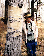
The old cowboy at  the back of the cave next to the small wall. Sorry about the focus. 


The All American Man is about 5 feet high and maybe 3 feet across at the widest point of the shield. At some time someone had outlined him with chalk .Now frowned on, this was often done by anthropologists/archaeologists to improve photos. Personally I find it quite helpful in these photos. As I remember that's the way it is in the Natioinal Geographic photos. There have been doubts about his authenticity, but he has been authenticated by radio-carbon dating to the 14th century and is attributed to the Anasazi people. He was not found, or at least not reported by whites, until the 1950's. I met one of the men who ranched and ran cattle in that area who had not seen it. I know this old cowboy has never seen anything like it. There are also a series of hand print pictographs on either side of him. Hand print pictographs are quite common in Anasazi country. 

The photo below shows a wider angle view of the All American Man. In this view you can see the number of hand prints made around him. The cave entrance is just out of view to the left; the small wall just out of view to the right. The second photo below is another shot of the All American Man.


After photographing and looking around the immediate area, we hiked back out. We got to our campsite just at dusk, pulled the stew out of the ground and had dinner. It was delicious!

The Park Service has become quite secretive about the existence of the All American Man. He does not appear on maps anymore and there is no mention of him on their website. In addition they have virtually locked up Salt Creek with a locked gate and permits needed to go a little ways by 4 WD or all the way by Shank's mare, roughly 21 miles. I understand the need for protection of artifacts, but at times it feels like they are trying to “save” this and other things for the elite. In any event I am glad I saw it; it was well worth the effort.


Monday, August 6, 2012

Portrait of the Artist as a YoungDog..er, Photographer. With Apologies to Dylan Thomas

About a year and a half ago I began a project to digitize(scan) all the film-based photos that I have taken over my lifetime, with the exception of photos that I took as part of assignments from publishers for books-in this case the publisher owns the copyright and I don't particularly care if those photos are digitized or not. At the start of this project I estimated approximately three years to completion. I have now revised that estimate upward. I hope I finish before I croak. Scanning transparencies is tedious and time consuming. I find that I can only scan about 50 35mm slides in one day without running out into the street screaming obscenities. Anyway, the other day I scanned some 35mm slides taken in south Cache Valley, Utah in 1991. These are probably on Fuji film, but I can't tell for certain without taking the slide apart, which I don't want to do. I use a Minolta Dimage 5400 II film scanner. One slide in particular stood out—a rural scene of an old farm, with mountains and the valley in the background, and with my 4x5 camera mounted on a tripod at the edge of the scene.

I usually carried a 35mm camera with me when I went out with the 4x5 to do landscapes. The 35mm is more agile and at times necessary to get a photo you might otherwise miss. The quality of the 4x5 is far superior, due to the size of the negative if nothing else. First I thought I was shooting with the 35 and forgot the large format setup was at the edge of the frame. Then I found another slide with the 4x5 at the other edge of the frame-must have been deliberate.

I believe this was an attempt to do a self portrait. This photo reveals a lot about the artist. He likes rural landscapes, as well as mountains. He likes beautiful skies with white puffy clouds. He is particular about his art. He would rather not photograph at mid-day, but early morning or late afternoon when the light is better. In this case not too late or the mountain shadows would be over all the scene. He uses the best equipment he can afford(4x5) mounted on the best, sturdiest tripod available. He also has a 35mm camera with him and is not afraid to use it when the circumstances call for it. He probably scouts locations that interest him and then returns at the right time of day or even time of year to get the shot he wants. He may be at a scene for many minutes to hours waiting for the sun to come out from behind a cloud. He is probably more deliberate than impulsive. Taking a photo with a 4x5 is a very deliberate process, requiring a series of manual steps done in sequence. Miss a step or get out of sequence, no photo. Experience has taught him about composition, depth of color and light as well as patience..

Below are scans of two of the 4x5 transparencies I took from this spot. Must have been from where the 4x5 is shown in the above photo, and earlier  as the mountain shadows have covered the farmstead in the 35mm photo. The film was a Fuji film; the scans were done on an Epson Perfection 1680 flat-bed scanner.
All in all a fun exercise. Also, Dylan Thomas' Portrait of the Artist as a Young Dog is an excellent read. I highly recommend it.


Friday, October 14, 2011

Autumn at Bear Lake


The opening photo is taken from Temple canyon looking east to the south corner of Bear Lake. The east side of the lake is in Wyoming.
Bear Lake is on the Utah-Idaho border, at an altitude of about 6000 feet. The primary trees that turn good colors in the fall are big tooth maples and quaking aspens. On this particular expedition my son Dean and I stayed at the Edwards Lodge on the shores of Bear Lake and enjoyed a tour guided by the Old White Haired guy and The Saint. Dean and the guides are shown below.


Below: View from Edwards Lodge


The series of photos that follow are from an area called Temple Flat. The trees that have turned yellow are quaking aspen("quakies"). If I remember my GPS readings right they are about 7500 feet high.


I love to shoot quakies backlit to capture the glow that the sun produces shining through the yellow leaves. You have to be careful doing this to keep the sun from shining directly on the lens. I have a lens shade that came with the lens but my favorie and most effective is my hat. If you are using a tripod it makes it a lot easier to use your hat as a sunshade. The effect of backlighting is shown in varying degrees in the photos below.


The image below was taken in Logan Canyon.

Tuesday, September 27, 2011

The Eagle and Bluebell, Eureka, Utah


The Eagle and Bluebell mine is an old mine in Eureka, Utah. Silver and/or gold was found in this area in the 1860's and the Tintic Mining District organized in 1869. The Eagle and Bluebell was begun around this time although under a different name. About 1897 it was purchased by the Bingham Mining Co, the same company that developed the huge copper mine in the Salt Lake Valley. The Eagle and Bluebell sits about halfway up the mountain to the south of the town of Eureka. Over time a very large tailings dump developed. A railroad spur was brought in to allow ore to be loaded directly from ore bins and transported to a smelter/mill. Between 1897 and 1916 220,000 tons of ore was taken out of this mine. From this ore 35,000 ounces of gold, 3.2 million ounces of silver, 1.4 million pounds of copper, 34 million pounds of lead and 23,000 pounds of zinc were extracted.


The photo above shows the Eagle and Bluebell surface plant.The head frame is positioned over the shaft; to the left the grayish building houses the hoist, basically an electrical winch, by which men and equipment are raised and lowered into the mine. The photo below shows the interior of the hoist room with the massive hoist.


The next photo shows the belt/cable running from the hoist out of the building. This belt goes over the wheel at the top of the head frame and attaches to the cage containing the men or equipment. The two large discs are part of the method by which the depth of the cages in the shaft was determined.


For me the most intriguing thing about the Eagle and Bluebell was the ore bins, shown below. Mine cars were run out onto the top and then dumped down chutes into the ore bins. The railroad track ran between the bins. The construction is massive. Many of these timbers are tree trunks. I do not know when this was constructed, but I believe it was early in the 20th century.


Below is a photo taken in the space between the ore bins where the train ran.


Below are two views from the top with Eureka in the valley below.


Below is the top of the ore bin structure without the shack. The tracks lead to the chutes via which the ore was dumped from the mine cars into the bins.


This is the shack on top of the bins. I don't think anyone will be running any mine cars out there any time soon.


The Eureka mines ran off and on during the great depression, then full bore through World War II. After that some of them ran sporadically into the 1970's.

My grandfather ran the substation for the electric company from 1917 until his retirement in the 1950's. His house and the sub were just down the hill and to the east of the Eagle and Bluebell. The miners generally walked to work and had worn a trail in the snow about wide enough for a man to walk on. This trail got nicely packed down and was a great sled run for my dad and his friends, at least until they encountered a couple of miners on their way to work. Miners and lunch buckets flew everywhere. Being wise and afraid of the consequences, the boys kept going.

A note on the photographs--I have photographed in and around Eureka several times over the years, although not recently. The only recent photo I could find on the internet of the ore bins was taken in 2006 and showed the top shack gone. I'm not sure what else has gone on in the interim. I guess I need to have another go at Eureka.

The photographs shown here were all taken in 1990, when I got permission from the caretaker to be on the property. The photos were all originally in color, 35mm transparency film, probably Fuji. They were scanned using a Minolta film scanner. The black and white conversions were done with Silver Efex Pro 2

Monday, September 12, 2011

Barns of Cache Valley

Cache Valley is a high mountain valley in northern Utah, home to Utah State University. Logan is the largest city in the valley. Cache Valley was a site for mountain men, fur traders and trappers to rendezvous in the first half of the 19th century. It was first settled by white men in the 1850's. The valley is very agricultural with a number of barns scattered around, some new and others in various states of disrepair. What follows are some that I have photographed over the years.

This first barn is on a hillside in Mendon, a small community on the west side of the valley.


This barn is also in Mendon. I love the pattern the lack of shingles makes with the light coming through the roof. The cupola is also from this barn.


I believe this handsome old barn is in Trenton.


The barn shown below is in Clarkston. I'm not sure but I think it may have been a house at one time. The horses don't seem to care one way or another and were singularly non-communicative.


The barn and old house shown below are in Clarkston. There is a newer, modern house on the place as well, not shown in the photographs.


This mural is on the side of a modern farm building/barn in Trenton.


This bit of whimsy is on a barn in Whitney, Idaho. The northern end of Cache Valley extends into southern Idaho.


The photo below is obviously not of a barn, but it is an abandoned bit of agricultural equipment. It is near Mendon.


This is what eventually happens to the old structures if not maintained. I hope the truck isn't needed in a hurry.