Monday, November 11, 2013

Veteran's Day and a Little Bit of England


At the beginning of World War II the Brits were running short of fuel, training aircraft, pilots, and airfields on which to train new pilots. They did have an abundance of lousy weather, which was not helpful for pilot training. Churchill asked Roosevelt if the United States could help by providing training fields, fuel and aircraft on which to train pilots. Roosevelt agreed and as a result six fields were established in the United States, called British Flying Training Schools(BFTS). BFTS No. 4 was built east of Mesa, Arizona and called Falcon Field, at the Brits request. The first cadets reported in September 1941. BTFS No. 4 operated until the end of the war in 1945. Some 2500 cadets went through flight training at Falcon Field. Of this number 23 were killed in training accidents and are buried in  a small section of the Mesa Cemetery. Six Americans also died during this time.

Every year a memorial ceremony is held at this site on the Sunday before Veteran's Day. We have attended several and always found them very moving Yesterday was no exception.

The photo below shows the area where the Brits are buried with the wreaths in place. This section is maintained extremely well.


This monument is at the south end of the section, next to the road. The names of the 23 cadets are on  a plaque on one side of the stone.

The Mesa Caledonian Pipe Band marched down the road before the start and took their place just east of the section, as shown below.


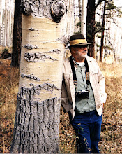
 There were several speakers but my favorite was the man shown below, a British cadet who attended BTFS No. 4.


There were several flyovers of vintage aircraft. The first photo below is of Stearman PT-17 biplanes in which the cadets at Falcon Field trained. The second photo is of  North American Aviation AT-6s, also used by cadets at Falcon Field. One of these groups flew over in the "missing man' formation.


I do not know what the aircraft are in the next two photos.


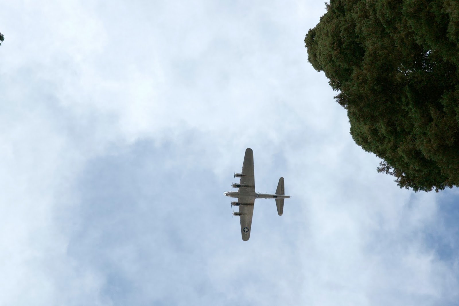
The first photo below is of a B-17  and the second photo shows a B-25. The Commemorative Air Force, based at Falcon Field is now the sponsor of this memorial event and supplied the aircraft, pilots and the flyovers.


 There were a number of wreaths placed during the memorial. The first photo below shows the wreath of Her Majesty's Government being placed by a Royal Navy Officer and a member of the British Consulate's office from Los Angeles, followed by a closeup of the wreath after placement.


The photo below shows the wreath of the Daughters of the British Empire, Arizona Chapter, being placed.


I am not sure to whom the wreath in the first photo below belongs. The wreath in the second photo is from Active Duty RAF Personnel, and is being placed by an RAF officer.


The laying of the wreaths was followed by a 21 gun salute by an American Legion squad, shown in the first photo below, and then by a bugler playing the British Tatoo(Last Post) followed by Taps, shown in the second photo below. I did okay until Taps; in a setting like this Taps always makes me teary eyed.


Following a benediction, the colors were retired, shown below.


We went back to the cemetery today and looked more closely at the inscriptions on the individual head stones. This one really got to me. Their only son killed and buried 5000+ miles from home.


We also visited my Father and Mother's graves, not far from this section in the same cemetery. Somehow it's fitting that as allies they should be buried nearby.


Wednesday, November 6, 2013

The Doll House and Spanish Bottom

I have recently posted two entries about Canyonlands National Park, The All American Man and Pictographs and Petroglyphs. Both of these posts were about the east side of the Colorado River. This post is about the west side of the river. The top map is a wide view of the Park; the bottom map focuses on the the west side.


In 1971 a friend of mine asked if I would like to go to Canyonlands to the Doll House and Spanish Bottom. Seems a friend of his from Washington, DC wanted to see that country and asked if Nelson would take him. Nelson said yes and I said yes and come Labor Day we were off. Nelson had a Scout, I think, the friend rented a Scout in Salt Lake City, I had a Ford Bronco and another friend came along in a four wheel drive pick em  up truck. The jumping off point for this expedition was Hanksville, shown on the top map. The Doll House and Spanish Bottom are about 50 miles south east of Hanksville, on the Colorado River about a mile south of the Confluence of the Green and Colorado Rivers. Hanksville is shown on the top map and the Doll House and Spanish Bottom on the bottom map.The photo below is an old meeting house/school house in Hanksville.


The Doll House is about 50 miles from Hanksville, most of which is on either dirt or rough slick rock 4WD "road". Someone on the internet recently said that it took him about six hours to traverse the last 20 miles. I don't doubt it; while not the worst road in Canyonlands, much of it is crawling along in low range four wheel drive. Above is a photo of my Bronco behind Nelson's Scout on the "road."


The four photos above are typical of the country we passed through on the way to the Doll House. This area is sometimes referred to as the "Land of Standing Rocks."

The friend from Washington DC was afraid of heights, but was absolutely determined to see this area for himself. A couple of times I looked in my rear view mirror to see his wife out walking in front of the vehicle guiding him. There are two photos of that action below. We are on a slick rock road with cliff face on one side and nothing on the other with some rocks/boulders to maneuver around. Compared to many other roads I have been on this one was almost a freeway; although it was funny to see, I couldn't laugh. He was determined to conquer his fear and, what's more, he did.


 We finally reached the Doll House, shown in the photos below. These formations sit right on the edge of the Colorado River Canyon. They are named the Doll House because some people think they look like armless dolls. As you can see the colors change with the light. The fifth photo down was taken just before sundown and gives them a golden glow.


The photo below was taken from the east side of the river, almost at the Confluence of the Green and Colorado. The Doll House is on the edge of the canyon almost in the center of the photo. At the time I took this photo I had not been to the Doll House and did not know what I was photographing besides the Colorado River Canyon.


At Spanish Bottom the floor of the canyon widens out a bit so there is some flat ground. Now river runners stop there and rest and fool around. There is a trail that leads down from the Doll House to Spanish Bottom. The vertical drop is about 1000 feet. The first photo below shows part of Spanish Bottom from the canyon rim about where the trail starts. The second photo shows the trail a little below the rim.


The first photo below is taken at Spanish bottom looking north; the second photo is taken from the same spot looking east across the river, where Lower Red Lake Canyon enters the Colorado canyon.


The first photo below shows some river runners on the east bank of the river and a raft just going out of sight on the right side. The next photo is of a river rafting company supply boat. A mile or so south of  Spanish Bottom the river enters Cataract Canyon, one of the wildest places on the Colorado in terms of rafting.


We camped at the Doll House; the final photo is of sunset one of the evenings we were there.


A note on the photos--these were all on Kodachrome, 35mm, taken with a Mamiya-Sekor 1000DTL camera. They were scanned using a Minolta Dimage Scan Elite 5400II.